4,655 meters above sea level
Monday, October 3, 2011
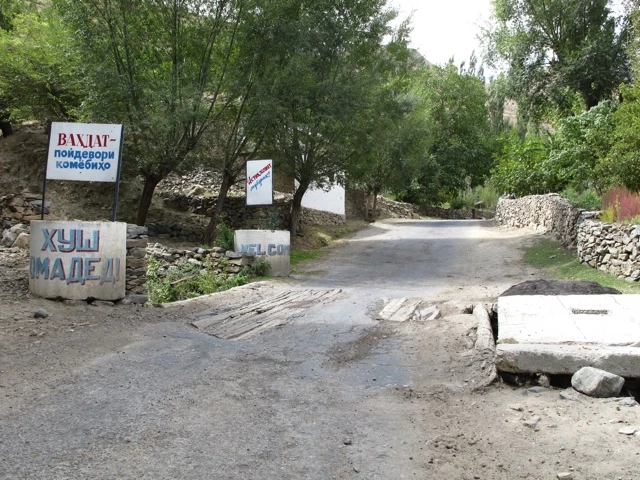
- Silkroad
Talon from Bristol, England, arrived at the guesthouse the evening before my planned visa extension attempt.
He had exactly the same visa as me and also wanted to try to extend it. Unfortunately, both of us caught another diarrheal attack. What a feeling! Pretty exhausted we ventured the next day an attempt at the consulate. Fortunately, at the same time a staff member of the German Embassy was there, which was very helpful. Unfortunately, it turned out that a maximum of 15 days an extension can be requested. But that takes 4-8 working days. Depending on how it works. Our consultant recommended that we should contact our embassies best. At the Swiss Consulate I was received very politely and the staff went out of their way to help me somehow. But at some point they also realized that it is quite difficult to extend a tourist visa in Tajikistan.
Talon was also unsuccessful at the British Embassy, so we decided to take a taxi to Khorog the next day. This would give us enough time to drive through the Wakhan Valley along the Afghan border in twelve days.
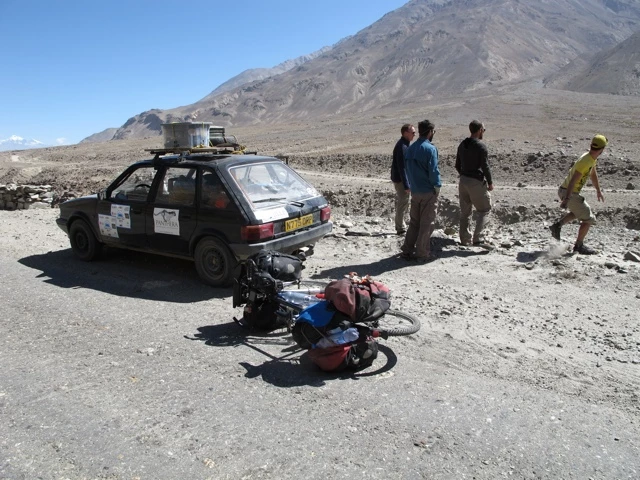
With Sebastian and Ines, two German backpackers, we met the next day at 7:00 clock at the bus terminal. Another tourist from Italy joined us. The 15-hour journey, in the convoy of five cars, started at 10 o'clock.
At first the road was well paved. Pretty soon, however, it was over and the shaking started. Somehow I like bicycle riding definitely better. We arrived in Khorog quite tired at 1 o'clock in the morning.
In the Pamir Lounge we met Tim and Andi from Switzerland potatoesonwheels.blogspot.com. They are also almost at the same time as I started from Switzerland and want to be in Thailand at the end of spring 2012. They took off with a Belgian Velopärchen one day earlier than we did. We still did not feel so fit and determined to recover a bit. In the evening Nora and Roman arrived. They had hitchhiked from Kalaikhum to Khorog in four days and we were able to see each other again.
To some extent it was the next morning at the bazaar first.

Shopping is not so easy here. You have to know pretty well what you want. After two hours we had reasonably everything together, what we thought necessary. Kurd, my bike, already groaned when driving under the load. In the Wakhan Valley it is quite difficult to find the right ingredients.
Shortly after Khorog the road followed the river. On the opposite side is Afghanistan. The farmhouses were sometimes so close that you could almost shake hands with people across the river. We were both deeply impressed by this fabulous landscape.

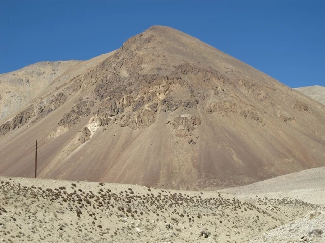
The Pamir, which is counted as the roof of the world, has an area of about 120,000 km², of which 1,200 km² are glaciated. The extreme north of the fold mountains belongs to Kyrgyzstan, the east to China, the south to Afghanistan, the rest to Tajikistan. The Pamir connects some of the great mountain ranges of Asia: Tianshan in the north, Karakorum in the south, Kunlun Shan in the southeast and Hindu Kush in the southwest. In the east of the Pamir, there is the highlands of Tibet, which is often referred to as the roof of the world.
The average height of the Pamirs is about 3,600 to 4,400 m, which is usually above the tree line here at 3,700 m. In the Pamir springs among other things the Pamir, the right source river of the Pjandsch. The largest lake in the Pamir is the Karakul in Tajikistan.
There are frequent earthquakes, one of which was created in 1911 by the Saressee. The climate is rough and dry. The inhabitants are mostly ranchers and keep yaks and fat tailed sheep.
The wildlife of the Pamir is naturally composed of high mountain species. Among the most famous, but also the rarest animals of the mountain range are the snow leopard and the Marco Polo Argali.
The Pamir claims 45% of the total area of Tajikistan, but only 3% of the total population live here. This is mainly due to the topographically difficult situation. The Fedchenko Glacier is one of the longest in the world with a length of 70 kilometers and there were also tons of interesting things to see in these twelve days.
After a short time, Franziska and Leo from Lucerne overtook us on their motorbike.
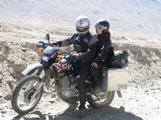
We met her in Khorog. They have rented a motorcycle in Kyrgyzstan and are now driving through Central Asia for a few weeks. In the coming days, our paths intersected frequently. They helped us out a few times with gasoline for the stove or a few bottles of water. Thanks a lot for de tolli support services Fränzi and Leo!
What impressed me most personally was the open and always extremely accommodating hospitality of the locals.

Through my two-month trip through Iran, I'm already used to a lot in terms of hospitality. But what we experienced here in Wakhan transferred everything. For example, when we wanted to get bread in a village, a farmer invited us to his home for Çay (tea). His wife served two plates of rice and came back a little later with a huge plate of potatoes. In the end they gave us two loaves of bread and a whole sack of potatoes, which they brought directly from the field.
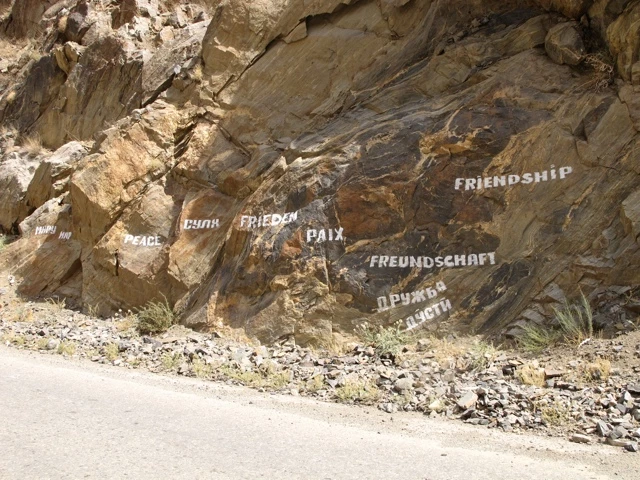
Every person who saw us waved and greeted us. In the evening my shoulder was almost luxuriant from the eternal wave. If all humanity were as gracious as these people here in the Wakhan Corridor, there would certainly be more peace on earth. The majority of the population lives from agriculture. In September there is a lot going on in the fields and so we could watch the rain from the bike.

Only once did we have an amusing argument with the locals: when we found a campsite next to a field only at nightfall, had already set up our tents and were cooking in the light of the headlamps, something flew in our direction.
We shone the surroundings and soon three men armed with sticks came towards us. We explained to them with a little Russian that we are only tourists who want to stay overnight. They started to laugh and explained that they had thrown potatoes at us. Nocturnal potato throwers. That's something else!

The Wakhan Corridor is a narrow strip of land in the Pamir Mountains in extreme northeastern Afghanistan, extending from the border with Tajikistan in the north and Pakistan to the south to a short border between Afghanistan and China in the east. Its length is about 300 km, its width varies between 17 km and over 60 km.
The Wakhan Corridor is a relic of the Great Game between Britain and Russia for supremacy in Central Asia at the end of the 19th century. He was to form a neutral zone between the British to India on the one hand and Russian Central Asia on the other hand.
The corridor is named after the river Wachandarja flowing through it in the eastern part, which in the middle part of the corridor unites with the Pamir to the Pjandsch.
The Wakhan Corridor is one of the most remote areas of Afghanistan. At its narrow point the Pjandsch forms the border with Tajikistan. At this point, one of the least developed regions of the world is in the immediate vicinity of the relatively advanced Tajik area with good roads and settlements.
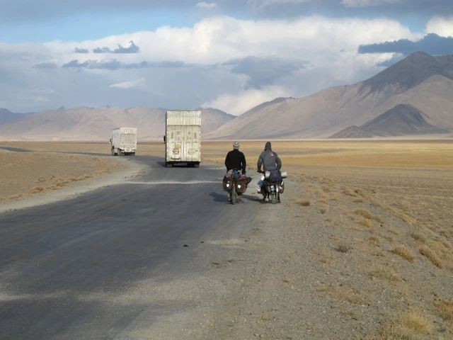
In Langar, the road branches off and leaves the corridor, which leads on to Afghanistan. After a short lunch break, we headed for Khargush Pass (4344 meters above sea level) and for the first time really up the mountain. Fortunately, a few children helped a lot with the poking. We finally gave them our old candies. They actually wanted to have sumonis (Tadjik currency currency, $ 1 equals about 4.75 sumonis). Unfortunately, this deal did not work for us. Sorry kids!
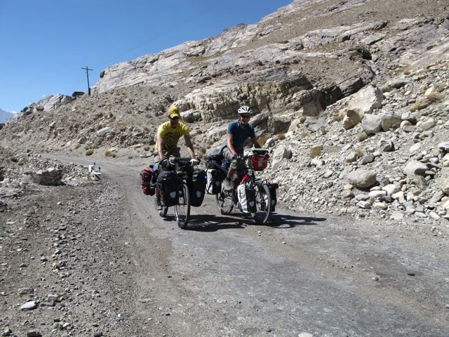
Cycling was relatively impossible on this road and on the larger slopes we had to dismount again and again and bump our bicycles. Only now did I slowly realize how difficult my dear Kurd really is. For this we were repeatedly rewarded with a wonderful foresight.


The next day, Jerry overtook us in London by car. He had already met us at the guesthouse in Dushanbe and handed over an ambulance to the hospital there. He now drives his second vehicle to Mongolia.
The altitude made us more and more difficult. Because of the sandy and rather stony road we came very slowly forward. Which was good. So we were able to acclimatise slowly and stood after three days of hard work on our first pass. What a feeling! Just a little below, we set up our tents.
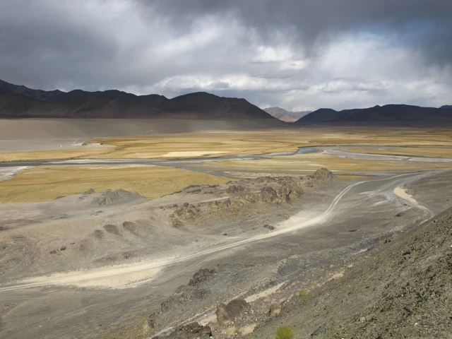
In the morning, the water in our drinking bottles was frozen, Talon had frozen with his thin sleeping bag and my bowel management was back in the bucket. This is how a good day starts. After only two hours we reached the asphaltened Pamir Highway. After only about a kilometer we met again on Climent from Spain. He already met us once in the Wakhan Corridor and was now also on the way to Murgab. He made us tea with toast. What a treat!
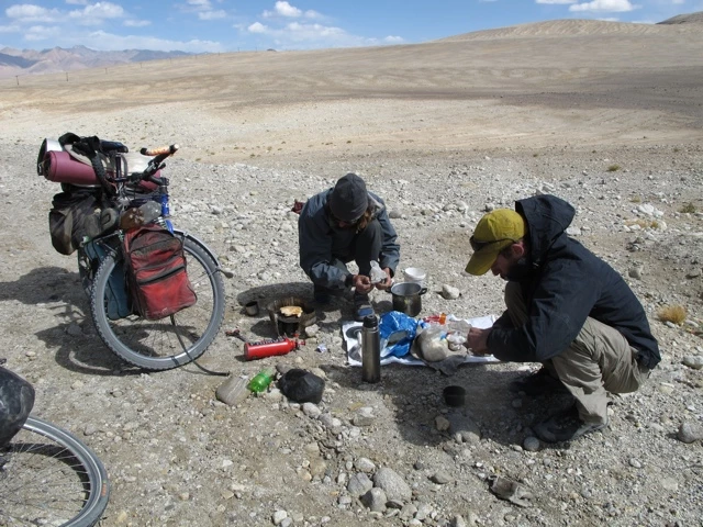
During the next two days, he accompanied us and told many exciting stories from his six-year journey through South America. Talon and I enjoyed the change. Most of the time, there was a strong headwind. In the Wakhan Corridor we had been spoiled with the finest tailwind and now the bill came back. All around us snowed and stormed. I was quite happy at night to have a good mattress and a warm sleeping bag with me. Sometimes it is worth carrying a little more weight. Exped definitely gave me a few warm nights.
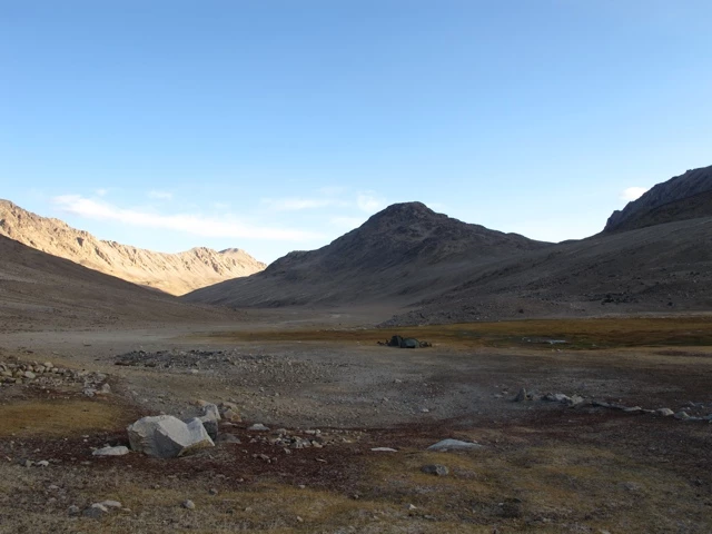
The landscape in the Pamir can be described almost exclusively with pictures:
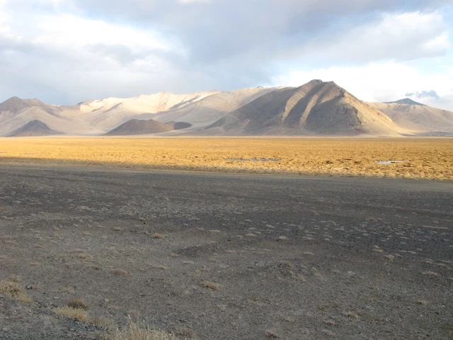
I have never seen such an untouched and deserted area in my life. In Murgab we had to say goodbye to Climent. We spent one night in the guesthouse, where we met again on Fränzi and Leo. It was the first time after eight days a shower and a delicious dinner. What a dream!
The rear wheel of Talon was pretty demolished and so we had next day shopping next to groceries and internet updating also doing an emergency surgery which cost us almost the whole day. Only at 17:00 o'clock the journey continued.
The next day was marked by the Akhaital Pass. He is 4655 meters above sea level. the highest passable pass in the Pamir Mountains. I had the feeling in the Serbian Tines that my lungs and heart are exploding every moment. Ueli Steck probably had the same feeling when he ran the summit ice field on the Eiger. At the top we were both quite overwhelmed. Done! My highest point of the journey!

The wind was quite strong and cold. After both of us had put on all our warmest clothes, we went down the gravel road back down into the valley.
In the next two days my stomach recovered quite quickly thanks to the many Snickers and antibiotic tablets. The water we drew from the springs and always disinfected well with Micropur did the rest of the work. But Talon had diarrhea again. A real ping pong game. Despite strong headwinds, we managed the Uy Bulak (4232 meters above sea level) and the Kizil Art Pass (4336 meters above sea level) for the next two days. The thin air was definitely not good for our brain cells. For example, we went for a ride on a steel yack
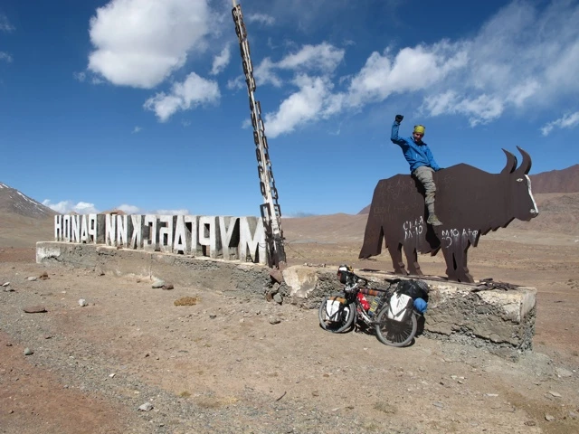
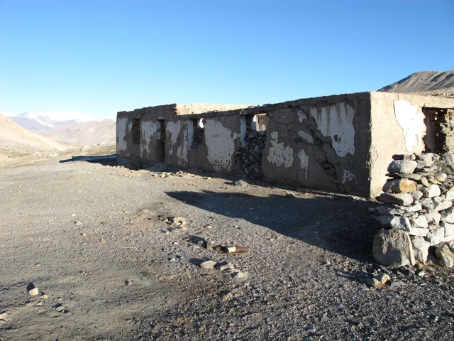
and kept a ruin that gave us wind protection for a three star hotel. Dear children: Take care that you do not lose your mind in the mountains.
At the border crossing I had to open my bags for the first time. At the end, however, the border officials offered us a Çay.
The Niemansland between Tadjikistan and Kyrgyzstan is probably one of the largest in Asia. The pass is too cold for the Kyrgyz and so they have set their checkpoint 20 kilometers down in the sheltered valley. As my visa for Tadjikistan expired on the 30th of August and the Kyrgyz was only valid from the 1st of October, we stayed overnight in Nomansland. Two English cyclists, traveling from Pakistan to their homeland, kept us company.


After a cold night (-15 degrees Celsius) we drove across the border to Kyrgyzstan and actually met real yak herds.

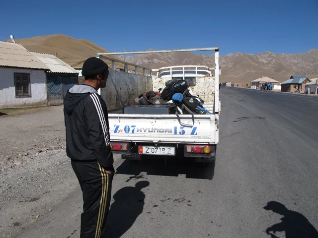
Arrived in Sari Tash, we were then confirmed what we had heard from other cyclists: For national celebrations, the dear Chinese have closed the borders for 10 days. The next day we decided to take a taxi to Osh to relax a bit and then cycle back to the border by bike.
Here in Osh I learned about the tragic death of Alex fernziele.info. I would like to express my deepest condolences to Bettina and all of my relatives.